
Portland Street - Cole Harbour Road Functional Planning Study
Project Background
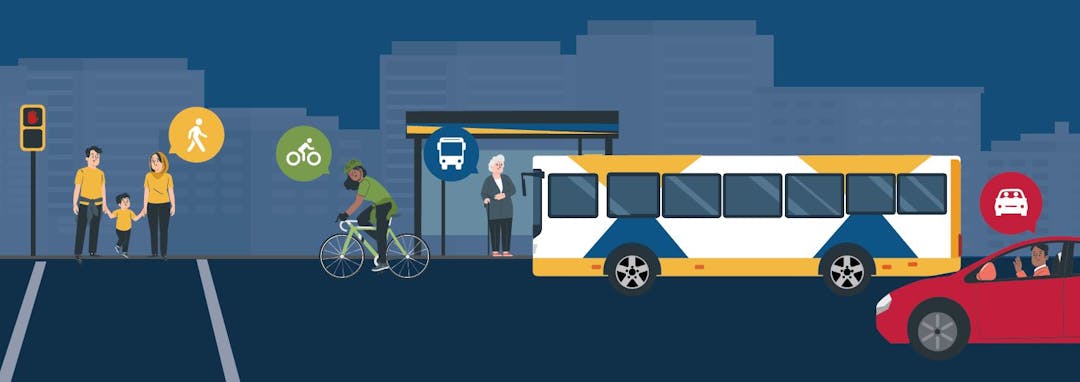
Portland Street and Cole Harbour Road are an important gateway and link between communities of Dartmouth and Cole Harbour with the rest of the Halifax Regional Municipality. It is estimated that upwards of 40,000 people travel along this corridor every day. This includes use by people driving, buses in mixed traffic, trucks on the designated truck route, as well as people walking/rolling on sidewalks and cycling in mixed traffic.
The context changes along the corridor and has been broken into three segments. Segment 1 (Alderney to Gaston) is most narrow at one lane in each direction surrounded by older homes and businesses directly abutting the sidewalk. Segment 2 (Gaston to Portland Hills Terminal) is the widest with at least two lanes in each direction surrounded by lower-density commercial properties and parking lots. Much of the emphasis on this section is accessing the Circumferential Highway and the area tends to experience congestion at peak hours. Segment 3 (Portland Hills Terminal) also has two lanes in each direction, with fewer cars that generally travel at higher speeds. There are some homes with smaller-scale commercial development on both sides.

What is Happening?
The Halifax Regional Municipality is planning on making incremental changes to Portland Street and Cole Harbour Road from Alderney Drive /Prince Albert Road to Bissett Road over the next few years. A study has been undertaken to develop a future vision for this street that seeks to:
- Provide high quality transportation options;
- Improve people-moving capacity;
- Build Complete Streets and with an emphasis on the pedestrian realm and placemaking;
- Improve road safety and areas of previous collisions.
This includes considerations like bus rapid transit implementation, wider sidewalks and boulevards, continuous off-road cycling facilities, and intersection improvements to help improve the comfort, convenience, and safety of all road users with a Complete Streets lens.
Why is this Project Happening?
Recent plans and policies emphasize the municipality’s commitment to investing in the Portland Street-Cole Harbour Road corridor as a critical link in our regional transportation network:
- Portland Street between Alderney Drive and the Portland Hills Terminal is dedicated as a ‘Transit Priority Corridor’ in the municipality’s Integrated Mobility Plan and is proposed to receive bus rapid transit (BRT) service as part of the ‘Red Line’ within the Rapid Transit Strategy.
- Large sections of the corridor are included in the Active Transportation Priorities Plan as ‘Bikeway Desired (Type TBD)’ as part of a larger connected cycling network in Dartmouth and Cole Harbour;
- The Integrated Mobility Plan also provides policy direction about managing congestion through providing connected, healthy, affordable, and sustainable transportation options that will help meet our mode share targets and reduce reliance on single occupancy vehicles.
- The Strategic Road Safety Plan and various safety audits of the corridor have led to recommendations for corridor-wide speed management and specific countermeasures at intersections to address areas of collision history and improve safety for all users.
- The HalifACT 2050 action plan includes decarbonizing transportation by expanding transit and active transportation infrastructure to help meet more sustainable mode share targets.
There is significant future development potential along the corridor as the municipality grows. Future areas of residential and commercial intensification will be investigated as part of the Suburban Plan process (ongoing); however, this growth will be supportive of a changing multi-modal ‘main street’ that represents the vibrancy of Dartmouth and Cole Harbour.
As such an important corridor, Portland Street-Cole Harbour Road presents both exciting opportunities and challenges for future planning. The project aims to develop future design options and scenarios that balance multimodal demands. This includes improved accommodation of modes that are currently underserved while maintaining adequate operations for those that are served well.
Project History
Functional planning began in fall 2020. The project team completed Existing Conditions Analysis and hosted the first phase of public and stakeholder engagement in April 2021. Materials and a What We Heard Report are available to download in the sidebar.
Shifting municipal staff capacity required project reprioritization that put this functional planning study on pause until fall 2023. Phase two of the project has been initiated with a revised scope and deliverables towards project completion by summer 2024.
This second phase will focus on:
- Development of conceptual design options for achieving project objectives
- Travel time modelling and evaluation of trade offs
- Public and stakeholder engagement before bringing the options to Regional Council
Upcoming Public Engagement Opportunities
Phase Two of public engagement took place in June 2024. Residents could have their say by participating in one of our public open house events or filling out the online survey. More details are available below:
Public Open House #1 -- COMPLETE
Thursday June 13th 2024 from 6 - 8pm
Micmac Aquatic Club (192 Prince Albert Road)
Public Open House #2 -- COMPLETE
Monday, June 17th 2024 from 6 - 8pm
Cole Harbour Place (51 Forest Hills Parkway)
Drop-in style with display boards and breakout tables for themed discussion. There was opportunity to review two design scenarios and ask questions of HRM staff. A major focus was on evaluation of trade offs. Which scenario best meets project objectives and matches your vision for the future of these streets?
Online Survey -- COMPLETE
An online survey was available at the bottom of this project webpage from June 10th through 28th. Thank you for your participation. The survey is now closed. Any further feedback can be sent by email to withers@halifax.ca
Survey material reflected what was presented at the Open House sessions including questions on the concept scenarios, trade offs, and future vision for the street.
Presentation boards for the open house events and the pre-recorded overview presentation are still available for download and viewing in the sidebar.
What We Heard Report -- FORTHCOMING
Now that phase two of public engagement is complete, project staff are compiling a report to summarize what we heard in terms of public feedback from each of these unique events and surveys. Stay tuned for these results!
Your input matters -- Public feedback will help us better understand the community's preferences and priorities regarding the project. Your participation is vital in shaping the future of our community. Responses will help to refine the concept designs and help move towards a recommended option for consideration of Regional Council
In summary, the Portland Street/Cole Harbour Road Corridor Project is a proactive response to the evolving transportation landscape and community needs. Through collaborative planning and strategic interventions, we aim to create a more accessible, sustainable, and vibrant corridor that enhances the quality of life for all residents and visitors to Dartmouth and Cole Harbour.


Videos
-
 Welcome to the overview presentation for Phase Two of public engagement for the Portland Street – Cole Harbour Road Functional Plan. This presentation will discuss the background behind this project, existing conditions, analysis methodologies, as well as provide an overview of the proposed design scenarios that are being considered for various segments along Portland Street and Cole Harbour Road.
Thank you for taking the time to view this presentation. We encourage you to provide feedback on the proposed design options by responding to the online survey, which can be found at: ShapeYourCityHalifax.ca/Portland-Cole-Harbour
Welcome to the overview presentation for Phase Two of public engagement for the Portland Street – Cole Harbour Road Functional Plan. This presentation will discuss the background behind this project, existing conditions, analysis methodologies, as well as provide an overview of the proposed design scenarios that are being considered for various segments along Portland Street and Cole Harbour Road.
Thank you for taking the time to view this presentation. We encourage you to provide feedback on the proposed design options by responding to the online survey, which can be found at: ShapeYourCityHalifax.ca/Portland-Cole-Harbour
Who's Listening
-

Email withers@halifax.ca